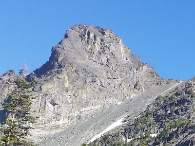
"Mount Baal"
ID
Elevation: 9,173' (LiDAR)
Rise: 195'
County: Idaho
Quad: He Devil
Line Parent: She Devil
Proximate Parent: Tower of Babel
Isolation: 0.35 miles
YDS Class: 2 Suggest Revision
Add ascent
Weather Forecast
Snow Depth
Images:
 mikeofferman 08-08-2016 |
Submit another Image
Trip Reports:
Submit a Trip Report
2025-07-26 - DerekPercoski
2020-08-27 - Nuernberger Josef
2017-07-04 - Brian Kalet
2014-09-14 - DavePahlas
1984-08-05 - Tom Lopez
Links: peakbagger.com
Ascents:
26 members have reported ascents...
log in to view ascents