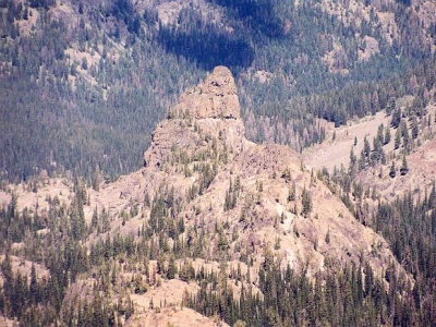
Devils Tooth
ID
Elevation: 7,834' (LiDAR)
Rise: 130'
County: Idaho
Quad: He Devil
Line Parent: 8740
Proximate Parent: 8740
Isolation: 0.67 miles
YDS Class: 5.x Update YDS Rating
Add ascent
Weather Forecast
Snow Depth
Images:
 Paul Klenke 11-09-2010 |
Submit another Image
Trip Reports:
Submit a Trip Report
Links: peakbagger.com
Ascents:
0 members have reported ascents...