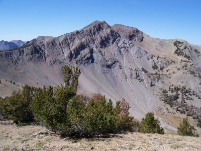
"Alta Peak"
ID
Elevation: 10,641' (LiDAR)
Rise: 682'
ID Rank: 221
ID Prominence Rank: 1340
County: Custer
Quad: Galena Peak
Line Parent: 10722
Proximate Parent: 10722
Isolation: 1.39 miles
YDS Class: 3 Suggest Revision
Add ascent
Weather Forecast
Snow Depth
Images:
 RickBaugher 03-30-2011 |
Submit another Image
Trip Reports:
Submit a Trip Report
2015-10-17 - DavePahlas
2012-09-09 - DavePahlas
2008-09-15 - RickBaugher
Links: peakbagger.com
Ascents:
7 members have reported ascents...
log in to view ascents