"Ross Peak"
ID
Elevation: 11,774' (LiDAR)
Rise: 1,049'
ID Rank: 29
ID Prominence Rank: 516
County: Custer
Quad: Massacre Mountain
Line Parent: McCaleb Benchmark
Proximate Parent: McCaleb Benchmark
Isolation: 1.92 miles
YDS Class: 2 Suggest Revision
Add ascent
Weather Forecast
Snow Depth
Images:
 KieranBalazs 06-23-2021 | 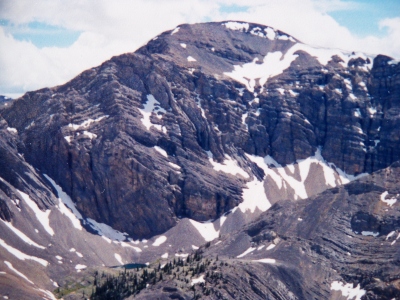 RickBaugher 03-30-2011 |  zdvickery 07-27-2010 |
Submit another Image
Trip Reports:
Submit a Trip Report
2021-09-18 - DavePahlas
2021-06-13 - KieranBalazs
1991-08-10 - RickBaugher
Links: peakbagger.com
Ascents:
28 members have reported ascents...
log in to view ascents