Wood, Mount - East
MT
Elevation: 12,676' (LiDAR)
Rise: 2,911'
MT Rank: 3
MT Prominence Rank: 52
County: Stillwater
Quad: Mount Wood
Line Parent: 12736
Proximate Parent: 12736
Stillwater County Highpoint
Isolation: 7.51 miles
YDS Class: 3 Suggest Revision
Add ascent
Weather Forecast
Snow Depth
Images:
 John Kirk 09-24-2019 |  KieranBalazs 10-31-2018 |  KieranBalazs 11-10-2015 | 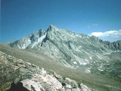 TWorth |
Submit another Image
Trip Reports:
Submit a Trip Report
Links: peakbagger.com
Ascents:
15 members have reported ascents...
log in to view ascents