Snowshoe Peak
MT
Elevation: 8,739' (LiDAR)
Rise: 5,439'
MT Rank: 1144
MT Prominence Rank: 3
Counties: Lincoln & Sanders
Quad: Snowshoe Peak
Line Parent: Doupe, Mount
Proximate Parent: Doupe, Mount
Lincoln & Sanders County Highpoint
Cabinet Mountains Wilderness Highpoint
Isolation: 80.20 miles
YDS Class: 3 Suggest Revision
Add ascent
Weather Forecast
Snow Depth
Images:
 ridgedancer 07-16-2024 | 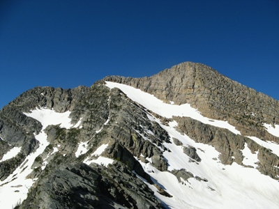 TWorth 08-25-2008 |
Submit another Image
Trip Reports:
Submit a Trip Report
Links: peakbagger.com
Ascents:
49 members have reported ascents...
log in to view ascents