Hilgard Peak
MT
Elevation: 11,315' (LiDAR)
Rise: 4,056'
MT Rank: 62
MT Prominence Rank: 15
County: Madison
Quad: Hilgard Peak
Line Parent: 11734
Proximate Parent: Ranger Peak
Madison County Highpoint
Lee Metcalf Wilderness Highpoint
Isolation: 76.50 miles
YDS Class: 4 Suggest Revision
Add ascent
Weather Forecast
Snow Depth
Images:
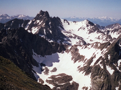 KieranBalazs 03-15-2018 | 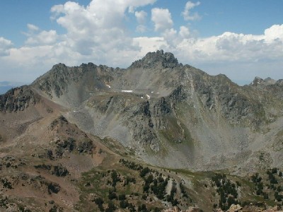 TWorth 08-11-2007 |
Submit another Image
Trip Reports:
Submit a Trip Report
2021-08-14 - Exflatlander
2018-08-05 - DavePahlas
2012-07-18 - BobBolton
Links: peakbagger.com
Ascents:
29 members have reported ascents...
log in to view ascents