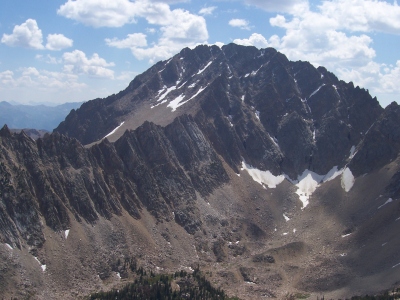
Castle Peak
ID
Elevation: 11,820' (LiDAR)
Rise: 4,016'
ID Rank: 26
ID Prominence Rank: 10
County: Custer
Quad: Boulder Chain Lakes
Line Parent: "Goat Mountain"
Proximate Parent: "Devils Bedstead East"
White Clouds Wilderness Highpoint
Isolation: 27.33 miles
YDS Class: 3 Suggest Revision
Add ascent
Weather Forecast
Snow Depth
Images:
 RickBaugher 03-30-2011 |  RickBaugher 03-30-2011 | 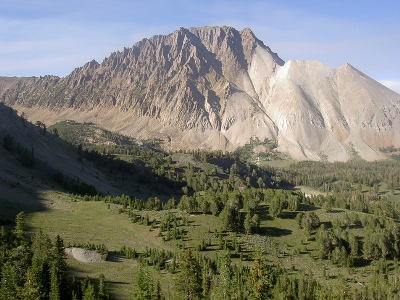 YogiClimber 02-06-2011 |
Submit another Image
Trip Reports:
Submit a Trip Report
2012-08-16 - Ken Jones
2010-07-03 - DavePahlas
1994-08-06 - RickBaugher
1985-07-24 - Tom Lopez
Links: peakbagger.com
Ascents:
65 members have reported ascents...
log in to view ascents