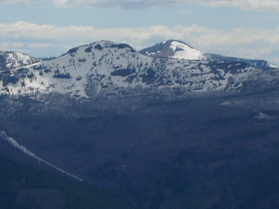
Strawberry Mountain
OR
Elevation: 9,046' (LiDAR)
Rise: 4,090'
OR Rank: 48
OR Prominence Rank: 8
County: Grant
Quad: Strawberry Mountain
Line Parent: Rock Creek Butte
Proximate Parent: Rock Creek Butte
Grant County Highpoint
Strawberry Mountain Wilderness Highpoint
Isolation: 46.16 miles
YDS Class: 1 Suggest Revision
Add ascent
Weather Forecast
Snow Depth
Images:
 Ken Jones 06-30-2008 |  BobBolton 04-26-2014 | 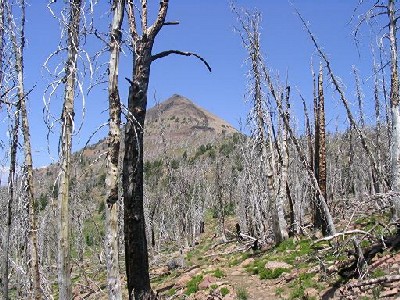 ScottSurgent |
Submit another Image
Trip Reports:
Submit a Trip Report
2020-09-08 - Nuernberger Josef
Links: peakbagger.com
Ascents:
84 members have reported ascents...
log in to view ascents