"Lost Temple Spire"
WY
Elevation: 12,515' (LiDAR)
Rise: 201'
County: Sublette
Quad: Temple Peak
Line Parent: East Temple Peak
Proximate Parent: East Temple Peak
Isolation: 0.12 miles
YDS Class: 5.8 Suggest Revision
Add ascent
Weather Forecast
Snow Depth
Images:
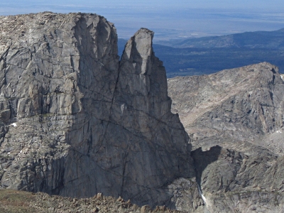 John Kirk 09-19-2019 |
Submit another Image
Trip Reports:
Submit a Trip Report
Links: peakbagger.com
Ascents:
1 member has reported an ascent...
log in to view ascents