Page 1 of 1

Correction for "The Portal"

PostPosted: Sun May 10, 2015 11:23 am
by Scott Patterson
LoJ list The Portal, in Grand County Utah near Moab as being an unranked summit of 4785 elevation. Just a note; "The Portal" actually refers to the narrowing of the river and the beginning of the canyon, rather than refers to point 4785.

Re: Correction for "The Portal"

PostPosted: Mon May 11, 2015 11:32 am
by John Kirk
Looks like a correction that needs to be taken up with GNIS then:
_.png

Re: Correction for "The Portal"

PostPosted: Thu May 28, 2015 8:53 pm
by Scott Patterson
Looks like a correction that needs to be taken up with GNIS then:


Ha! Definitely. The Portal actually refers to the narrowing of the river. In fact, the Portal Trail is actually on the opposite side of the river than The Portal "summit" listed.

https://www.google.com/search?q=the+por ... 0&ie=UTF-8

The BLM also says The Portal refers to the narrowing of the river:

http://www.blm.gov/ut/st/en/fo/moab/rec ... trail.html

If you look at all of the photos of The Portal they either show the trail on the opposite side of the river or the narrowing of the river itself:

https://www.google.com/search?q=the+por ... 40&bih=809

Not one of them ever emphasizes the tiny summit, which is basically unremarkable and visually undistinguished.

Historic photos also always refer to the narrowing of the river as The Portal:

Image

Caption:

The Portal view from Moab Valley shows the Colorado River winding through red cliffs.

http://www.deseretnews.com/article/7000 ... tml?pg=all
Re: Correction for "The Portal"

PostPosted: Fri May 29, 2015 9:01 am
by John Kirk
OK - I added a note on the page about the improper classification.

Re: Correction for "The Portal"

PostPosted: Fri May 29, 2015 12:25 pm
by Scott Patterson
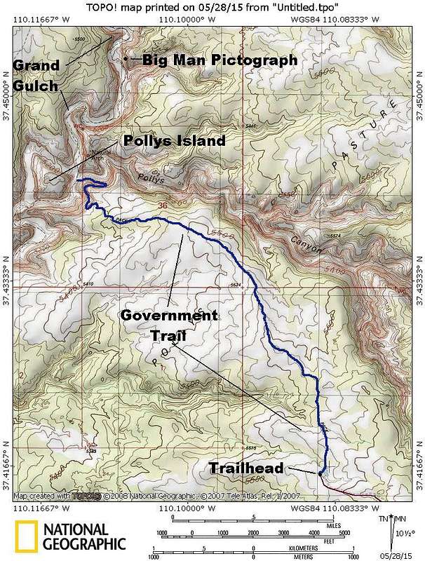
Speaking of GNIS classifications, check this one out:

Pollys.JPG


Pollys Island is actually a butte out in the middle of the desert.

Image